 |
| 11.15.12 |
Hi!
I am home, and all is well. My photos are safely moved to my big computer, no more itsy-bitsy netbook for me. My son fixed the wonky wifi last night, don't you just love having kids?! I was gonna show you more NYC but of course first thing I did, well after a couple loads of laundry, was run out to my beach. So I'll show you NYC flea markets this weekend, because for now...we are going to the beach!
[Can you tell how happy I am?]
This is what I saw:
east....
west:
Straight ahead, south...very peaceful now, isn't it....
East-south-east, out the Long Island coastline.....
Back towards the north, or bay...
 |
| geese, headed to the golf course,lol. not south |
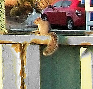
My little friend!? He waddled right over for his bread!
These are the highest inner dunes now. They survived though very changed.
The dull color is from the the seawater; it kills the green plants' leaves/ stems, though the roots survive. You can see the swales, the water behind the reeds. These semi-natural swales give normal storm surges room to flood but usually not overwhelm.
The above dunes are the ones I showed you a few weeks ago, when they were high rolling ''hills'' covered with pines, bayberry, heather, woolly grey lambs-ear, moss, and seagrass....
 |
October '12
|
 |
| Oct 2012 |
The outer dunes now, seen in the far distance in the above pic,
...are, well, gone; [above] though I suppose the sand is there somewhere.
More outer dunes, gone after Sandy .
To the east again,
Now...
before...
And the familiar boardwalk, now.[note the dunes on each side, once perhaps 20 feet high, are gone!
 |
| before |
 |
| now |
 |
| before |
 |
| before |
Now we know why these signs are here! Or were here. But the beach will recover. When I first moved here there were no dunes at all, not a speck of vegetation , just hundreds of feet of pristine white sand. A lady in our community fought hard to get these dunes built! We planted seagrass, dug swales or catch basins, so more plants would grow; beach roses and bayberry were introduced. This took years...but her vision saved my tiny community. And the beach will rebuild on the bones left behind.
 |
| 10.25.12 |
Speaking of bones...tomorrow I'll do a separate post, part two..with all my cool beach finds---antique/ bottles, driftwood, and a very old 19th century shipwreck!
so please check back!
Thanks to Surf Fire Island for this interesting Sandy data:
Buoy 44065 saw a 32.5' wave height at 8:50pm on October 29; this buoy is located near the entrance to New York Harbor, roughly 15 nautical miles southeast of Breezy Point, NY. This exceeded the previous record of 26' set at about 9am on August 28th, 2011, associated with Hurricane Irene.
Buoy 44025, which is roughly 30 nautical miles south of Islip, NY, a record 31' wave height was recorded at about 8pm on the same evening. This exceeded the previous record of 30 feet set on December 11, 1992.
I guess I should be glad we couldn't these waves, it got so dark! Now just a memory....
love
lizzy
gone to the beach.....!
and from Fire Island, NY, so apropos...if misspelled!
 |
| ''*we're* coming back'' |
PS Today, Nov 15th, 17 days after Sandy destroyed much of the NY/ NJ shoreline and many communites in ignored Long Island...President Obama finally did a flyover! He didn't stop, mind you, he FLEW over. He did stop in Staten Isalnd where the guy interviewed on TV said, ''...I thought it was just a publicity thing, you know, a photo op...''.
Yeah, me too.
I didn't look it up but I bet it didn't take the president almost three weeks to go to NO after Katrina. [*Bush flew over NO 2 days after Katrina; he was highly criticized fpr not putting''boots on the ground.'' This is not a political blog. I believe a show of Presidential leadership is essential during a crisis. I do not live in NYC, Bllomberg is not my mayor; so his refusal to have FEMA prior help is not relevant to my area.
No more politics here. Ever. I promise.]


.jpg)


